How Eratosthenes chose to measure the Earth with a shadow
Around 240 BCE a librarian in Alexandria could have repeated an old guess at the size of the Earth. Instead he chose a shadow, a city on the tropic and a distance he never checked himself.
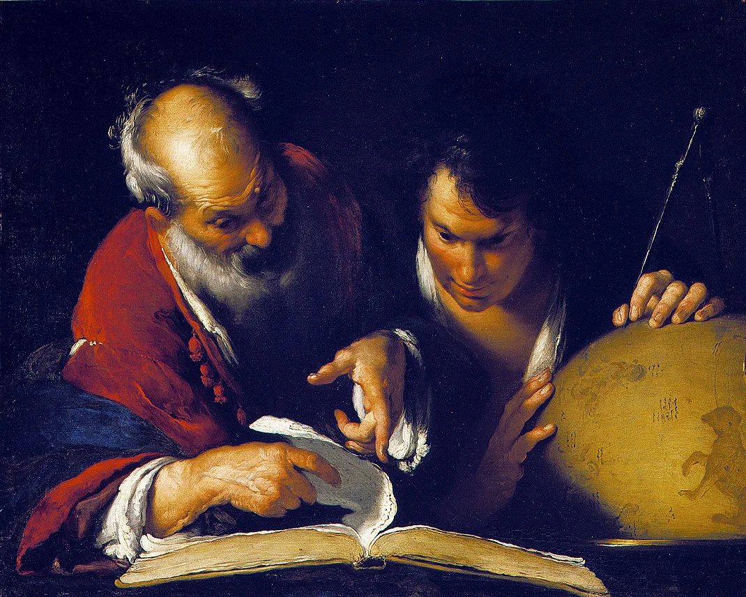
c. 240 BCE · Alexandria. Eratosthenes chose to measure the size of the whole Earth from two places in Egypt, a shadow and some geometry.
The situation
Educated Greeks of the third century BCE agreed the Earth was a sphere. Nobody agreed how big it was. Aristotle, a century earlier, had reported that mathematicians put its circumference at 400,000 stadia. Archimedes noted that some had tried to show it was 300,000, and to be safe he assumed it might be as large as 3,000,000. The figures were numbers without a method anyone could check.
Eratosthenes, born in Cyrene around 276 BCE, had studied in Athens and come to Alexandria as tutor to the son of King Ptolemy III. Around 240 BCE he became head of the great library. He wrote on mathematics, astronomy, chronology and poetry, and his Geographica is the first known work to carry the word "geography" in its title.
His own book on the measurement is lost. We know the method mainly from Cleomedes, writing centuries later in simplified form. So the forks below are told from a thin record. The options are mostly our reading of what was open to a Greek scholar in Alexandria then, not choices he is recorded weighing.
The choices
c. 240 BCE · Measure the Earth, not repeat an old figure
The library held the earlier estimates. The two best known were 400,000 and 300,000 stadia, a gap of a quarter. No surviving source says how either was reached.
The easy road was to quote one of them. Aristotle's 400,000 carried the authority of the most famous philosopher of the age and cost nothing, though nobody could test it and it might be badly wrong. The smaller 300,000 was newer, and by Archimedes' account some had tried to prove it, but it was just as hard to check. The hard road was to measure the planet himself. A figure built from stated assumptions and measurements would be his own, and it would expose him: anyone could repeat the steps and attack each one.
- Quote Aristotle's 400,000. Famous authority at no cost, but nobody could test it.
- Adopt the newer 300,000. Some had tried to prove it; just as hard to check.
- Measure it. A figure of his own, open to anyone who wanted to attack it.
He measured. His reasons are not recorded; what survives is the result, a treatise titled On the Measurement of the Earth. Our reading is that a geographer needed a number he could defend. The cost was exposure. Every assumption became a target, and historians still question each one.
Use the Sun's shadow, not a star
Greeks knew the sky shifts as you travel north or south. Aristotle had pointed out that some stars seen in Egypt and near Cyprus were not seen further north, and that a small change of position alters the horizon. The noon Sun shifts too. Either could, in principle, turn a north-south journey into an angle.
A star was the obvious instrument for an astronomer. A bright southern star could be watched from two cities on any clear night. But stars near the horizon are hard to fix precisely. When Posidonius took exactly this road with the star Canopus more than a century later, his angle came out at 7° 30' where it should have been about 5° 15'. The Sun offered something plainer: the shadow of a pointer at noon on midsummer day, one hour on one day, a mark anyone could see. Its price was one bold assumption, that the Sun is so far away its rays reach every part of the Earth as parallel lines.
- Measure a star's height. Any clear night would do, but stars near the horizon are hard to fix.
- Use the noon shadow at midsummer. A mark anyone could see, resting on parallel rays from the Sun.
He chose the Sun. Cleomedes gives the method, not the motive. The likeliest reading is that a shadow is easier to measure than the height of a faint star near the horizon, and that the Sun offered a natural zero point, as the next fork shows. The cost was a single chance a year, at noon on the solstice, and an assumption he could not prove. It held: the Sun is about 150 million kilometres away, far enough for its rays to count as parallel here.
Pick Syene as the second place
The geometry needed a second city on the same north-south line as Alexandria, at a known distance. Ptolemaic Egypt stretched south along the Nile, and the sea lay open to the north.
Rhodes was a short voyage across that sea. Yet a sea distance could only be estimated from sailing times, and how badly that could go shows in later reports, which put Rhodes to Alexandria at a "reputed" 5,000 stades in one account and 3,750 in another. Meroë, far up the Nile, tempted for the opposite reason. It lay another 5,000 stadia beyond Syene, by Strabo's figures, so the angle would be about twice as large and a small misreading would matter less. But its distance rested on travellers, and travellers gave journeys, not measurements: the Ptolemaic admiral Timosthenes described the trip from Syene only as "a journey of 60 days". Between them lay Syene, modern Aswan. There, at the summer solstice, the Sun stood at the zenith and a vertical pointer cast almost no shadow. One end of the measurement would be zero.
- Look north to Rhodes. A short voyage, but a sea distance could only be guessed from sailing times.
- Go far south to Meroë. About twice the angle, but a distance known only as a 60-day journey.
- Use Syene, on the tropic. Almost no shadow at midsummer noon, so one end of the measurement was zero.
He chose Syene. Here the reasons do survive, as geometry: in Cleomedes' account, Syene lies under the summer tropic, and Syene and Alexandria lie "under the same meridian circle". The cost was that neither statement is quite true. Syene is not exactly on the Tropic of Cancer, and it lies a few degrees east of due south from Alexandria. Some of those errors happened to cancel out.
Take the distance as 5,000 stadia
At noon on the solstice the shadow of a pointer in an Alexandrian sundial bowl marked out an arc, which Cleomedes says was one fiftieth of a full circle, a little over 7 degrees. So Syene to Alexandria was one fiftieth of the Earth's circumference. Now everything hung on the distance. Any error in it would be multiplied by fifty.
Three ways lay open. Having the road paced or surveyed would give him a fresh measurement of his own, at the price of time and royal backing; a popular account says he did exactly that and hired bematists, professional pacers, though the classicist Peter Gainsford argues the evidence for pacing is thin. Converting travel times into distance was what others did, as Timosthenes' 60 days shows, but turning days on the Nile into stadia was guesswork. Or he could take the figure already in hand. Syene to Alexandria was 5,000 stadia, a suspiciously round number. Martianus Capella, writing centuries later, says Eratosthenes took the distance from Syene to Meroë from Ptolemy's royal surveyors; the same may be true of this leg.
- Have the road paced or surveyed. A fresh measurement of his own, at the price of time and royal backing.
- Convert travel times into distance. What others did, but days on the Nile made stadia a guess.
- Take the 5,000 stadia in hand. Ready to use, but a round number with its error hidden.
Cleomedes says only that he took the distance as 5,000 stadia. How he got it is not recorded. Elsewhere Eratosthenes admitted that for remote regions he repeated distances as he received them, without verifying them. The cost was hidden error. Gainsford calls the distance data poor and the final accuracy partly luck.
Publish 252,000, a number a mapmaker could use
Fifty times 5,000 gave 250,000 stadia, the figure Cleomedes reports. Most other ancient writers, Strabo among them, give 252,000.
The bare 250,000 was faithful to the arithmetic, and it looked as rough as the inputs really were. Nudged up to 252,000, the figure divides evenly by 60 and by 360, giving a neat 700 stadia per degree, handy for anyone drawing lines of latitude on a map. The price of the neater number was a look of precision the measurements could not support.
- Publish the bare 250,000. True to the arithmetic, and as rough as the inputs really were.
- Round to 252,000. A neat 700 stadia per degree for mapmakers, with a look of false precision.
We do not know for certain that the change was his, or why it was made. Most reports give 252,000, and Gainsford thinks 700 stadia per degree is the likeliest reason. The difference is under 1 percent, small next to the doubt in the distance.
What it changed
The method was the achievement. It turned the size of the planet into something anyone could measure and check, using geometry, two places and a distance. Later geographers used his figure and his approach for centuries.
How close he came depends on which length of stadion he used, which we do not know. On one reading his result is within about 2 percent of the true polar circumference of about 40,000 kilometres; on another it is about 16 percent too large.
The road not taken
The biggest fork was the stars. Posidonius later took that road, with Canopus, Rhodes and Alexandria. A wrong angle and a doubtful sea distance gave him 240,000 stadia, close only because the errors offset each other. With a revised distance, the same angle gave 180,000 stadia, far too small, and that smaller figure is the one Ptolemy later repeated.
Had Eratosthenes started from a star and a sea crossing, he would probably have met the same two weak points: a low star that is hard to measure and a distance that could only be guessed. His figure could easily have come out far too small. The shadow at Syene gave him a zero at one end and a distance along the Nile at the other, and a result that held up.
Legend and record
None of Eratosthenes' own account survives. The popular detail of a deep well at Syene, lit to the bottom by the noon Sun, comes from other ancient writers describing Syene, and may not have been part of his argument. The story that he hired professional pacers to walk the distance is uncertain. Some scholars doubt he used a sundial bowl at all and think he used a more precise instrument. The painting above, made in 1635, is an imagined scene: no portrait of Eratosthenes exists.
Sources
- Eratosthenes (MacTutor History of Mathematics, University of St Andrews)
- Posidonius of Rhodes (MacTutor History of Mathematics, University of St Andrews)
- Eratosthenes of Cyrene (Encyclopaedia Britannica)
- This month in physics history: Eratosthenes measures the Earth (APS News, American Physical Society)
- Cleomedes' Lectures on Astronomy: A Translation of The Heavens, by Alan C. Bowen and Robert B. Todd (University of California Press, 2004)
- Cleomedes on the size of the Earth, in T. L. Heath's translation (quoted by Roger Pearse)
- Aristotle, On the Heavens, Book II (MIT Internet Classics Archive)
- Archimedes, The Sand Reckoner (English text, hosted by Robert Munafo)
- Strabo, Geography, Book II, chapter 5 (LacusCurtius, University of Chicago)
- How Eratosthenes measured the earth, part 2, by Peter Gainsford (Kiwi Hellenist)
- How Eratosthenes measured the earth, part 3: the distances, by Peter Gainsford (Kiwi Hellenist)
- How Eratosthenes measured the earth, part 4: the angle, by Peter Gainsford (Kiwi Hellenist)
- Geography: the emergence of geography (Encyclopaedia Britannica)
